Would municipal workers be more inspired and productive, and politicians more informed and less corrupt, if they worked inside a building similar to some of the beautiful city halls shown in the link below? For the record, I think the examples from Dallas and San Jose are quite ugly.
http://www.governing.com/topics/transportation-infrastructure/gov-big-bold-city-halls.html
Sure, to some extent, good architecture and aesthetic beauty
is subjective. But would anyone really argue that the Indianapolis
City-County Building could be inserted into a list of great city halls
as anything other than a silly joke? Or that Indianapolis is a better
city for having vacated the old city hall and county courthouse (seen below before being demolished) in favor of the City-County Building constructed in 1962.
http://historicindianapolis.com/a-room-with-a-view-city-county-observation-deck-western-view/
It's probably not too controversial to opine that Indianapolis's image, and more importantly its collective civic pride, would've thrived more by maintaining its old city hall and county courthouse. (The old city hall building lives on, having served as the Indiana State Museum and interim home for the Indianapolis-Marion County Public Library, but has been neglected for several years despite a recent plan to move a few city planners to a small portion of the building. The county courthouse was demolished shortly after construction of the existing city-county building.) But more interestingly, this made me wonder whether the replacement of these two beautiful buildings with one bland structure could be viewed as a precursor to the quality of both private and public development that followed the merger of the city and county governments under the moniker of "Unigov" starting around 1970.
What inspirational development has occurred in the consolidated city of Indianapolis in the last 40 years? I didn't live here in the '70s, '80s, or '90s, so maybe someone else would be better suited to provide examples, but I can't think of much that appears to be from that era other than a few run-of-the-mill office skyscrapers, plenty of strip malls, a plethora of "big-box" stores and indoor shopping centers surrounded by dozens or hundreds of acres of surface parking (typically with scant, if any, landscaping), and endless residential developments with substandard infrastructure (missing sidewalks, curbs, street lighting, etc.) and uninspired building design. Clearly, these three decades didn't seem to produce much of anything that we will collectively be sad to see disappear whenever it deteriorates and is eventually abandoned and redeveloped.
Has the 21st Century provided a turning point for Indianapolis in how its development inspires collective pride, and hopefully civic engagement? The downtown Fieldhouse (currently sponsored by Bankers Life), Lucas Oil Stadium, the expanded Indiana Convention Center; do these buildings inspire us and will we take in pride and maintaining and preserving them for many decades or centuries to come? Downtown's Cultural Trail has widely received accolades from around the country. Will this lead to a strong demand for better public streets throughout Indianapolis in place of the horrendous roads, designed mostly to move cars as quickly as possible with little, if any, consideration given to anyone outside of a car, that predominate the landscape?
Did the consolidation of the old city limits of Indianapolis with the sparsely developed outer portions of Marion County lead to a watering down of expectations for private development, government action, and public participation? While I've long supported the idea that local government consolidation can provide many benefits through efficiency and creating a more equitable property tax base, I can't help but wonder whether, in the case of Indianapolis, that a smaller jurisdiction might've resulted in better public development as citizens might've had an easier time interacting and engaging with a smaller local government, and the government might've been more inclined to seek public input to ensure that projects were well suited to the diversity of neighborhoods found in a 400-square mile county. If most of your votes are coming from very different, far-away neighborhoods, it might not come as a surprise that politicians don't make public input in those areas a priority. Certainly, it's at least a little bit harder to create appropriate street designs in a consolidated county that includes typical urban, suburban, and rural areas, than it would to do for just one of the three. Maybe I'm just looking for an explanation to excuse Indianapolis's woefully inadequate street designs that have only recently started to show limited signs of improvement. Nonetheless, it's well beyond time for Indianapolis to make a habit of inspiring citizens and visitors with its public development, which might result in better private development as well.
Tuesday, November 12, 2013
Monday, October 7, 2013
I live in ___________, but I have a _____________ address.
Well, it's been quite some time since I made an entry. Beginning now, I plan to add entries several times a week, so cue the excitement.
For my return to the blogosphere, I ease back into things by tackling a fairly light subject regarding addresses. When I moved to Indiana, I was confused to hear people say something like "I live in Indianapolis, but I have a Zionsville address." What in the heck does that mean?!? You live where you live. If you live in Indianapolis, how can you possibly have anything other than an Indianapolis address?
Perusing the real estate ads today, I saw a listing for a house in Hamilton County near 102nd St & College Avenue. The house was clearly north of 96th Street which is the Marion-Hamilton county line. We all know that Indianapolis does not extend into Marion County and this area north of 96th Street near College Avenue is within the City of Carmel. Yet, the real estate listing indicated that the house had an Indianapolis address but was in the Carmel-Clay school district.
How is it that a house in the City of Carmel has an Indianapolis address? I suspect that perhaps it has something to do with where the post office is located for that particular zip code. What I don't get is why people have come to believe that their address might be different than the reality of where they live. If you live at 102nd & College and give out your address as 10200 N College Ave, Carmel IN 46280, is your mail not going to be delivered because you are told that you have an Indianapolis address, not a Carmel one? I can't imagine it wouldn't get delivered. I always thought that, with the advent of zip codes, the city listed on your address really wasn't relevant since it would be so highly improbable that there the same street address would exist in two municipalities that share a zip code. In fact, when I once lived in the Twin Cities suburb of Apple Valley, I would often, just for fun, give out my address as being in St. Paul and was not aware of any issues whatsoever with getting my mail successfully delivered.
I don't get it. I even recall people saying that certain neighborhoods were more desirable because they had addresses in a particular municipality even though it was known that they were actually within a different municipality. I certainly want to believe that the post office is capable of delivering mail to two different municipalities within the same zip code. Is there something unique about Indiana and this phenomenon of living in one municipality, but having an address in a different municipality? Please clue me in and/or let me know if I'm wrong on this one.
Tuesday, November 6, 2012
Election 2012
As President Obama is being projected as the winner of a second term in the White House, I am watching scenes of people dancing in the streets near Times Square, and I am thinking: what is wrong with these people? What could they possibly be so excited about? The only result that I can imagine that could've actually been worse than this, is if Romney had won.
Sunday, December 12, 2010
10th & Bellefontaine
Walked around in the snow this afternoon at this newly completed (?) intersection which serves as the terminus of the northeast leg of the Cultural Trail. I appreciate the apparent efforts to make the intersection more hospitable to pedestrians, however, a few parts of the design seem odd and confusing. First, the right lane of eastbound 10th Street ends, just prior to the intersection instead of being a right-turn only lane onto Bellefontaine. I guess I don't object to eastbound through traffic and the occasional right-turning vehicle sharing the same lane, but I hope that on-street parking will be permitted in the right lane between College and Bellefontaine as I believe it is west of College. What's really strange to me is the right-turn lane from northbound Bellefontaine to eastbound 10th Street. After a vehicle begins into the rounded right turn lane that is designed to accommodate turns at a much faster speed than a regular right turn, the driver encounters a traffic signal.
There's no sign indicating that the right turn can't be completed without waiting for a red light, but I presume that's the point since a crosswalk runs right in front of the stop line. All of the drivers I witnessed proceeded through the right turn without waiting for a green light, most not even stopping for the red light. It seems to me that the design of the right turn lane sends a mixed message to drivers: such rounded turn lanes are typically designed to allow right turns to occur at any time without stopping, but yet at this location where the Cultural Trail crosses 10th Street to connect to the Monon Trail, obviously, the intent was to give preference to and provide safety for pedestrians and bicyclists. The rounded right turn lane fails as the design allows vehicles to complete the turn (into a reborn eastbound 10th Street right lane) while the single lane of 10th Street traffic proceeds through the intersection as well.
At a minimum, I think there needs to be a sign prohibiting a right turn from Bellefontaine to 10th on red. However, I think that pedestrians and bicyclists would be safer if the right turn movement was a 90-degree turn that would actually require drivers to slow to a safe speed. For that matter, I'm not sure why there's no left turn permitted from Bellefontaine to westbound 10th Street. The only crosswalk is on the east side of the intersection so there'd be no conflict with ped/bike traffic, and it would certainly be helpful for someone who has been unsuccessful at finding a parking space on Mass Ave or Bellefontaine to be able to circle back around by going west on 10th and south on College. Most such drivers will be considerably inconvenienced by being required to travel east under I-70/I-65 to either then make a u-turn or a series of several turns to get back to the west side of the Interstate.
Tuesday, September 7, 2010
Sidewalk Reconstruction on Dr. MLK Jr. St.
Check it out! Along with resurfacing the street, the City has rebuilt many of the sidewalks along Dr. MLK Jr. Street between 16th & 21st Streets.
 The above photo is looking south on the west side of MLK, across from 17th Street. A newly constructed, smooth walking surface should enhance pedestrian safety and enjoyment.
 Unfortunately, upon closer inspection it becomes apparent that there are some serious deficiencies in the design of these sidewalks. While it would appear that the City was simply "replacing like for like", I'm not sure that exempts this project from the requirements of the Americans with Disabilities Act.
 I'm not a lawyer, so I'll not speculate on what would happen if a lawsuit were filed, but I do know that a minimum width of 36" (for one-way traffic) is required for any walkway intended for public use, and a minimum 60" path (to provide for passing) must be provided at regular intervals (something like every 100-200 feet). Thus, cities typically adopt a standard requiring a minimum 60" sidewalk width, but narrower widths can be acceptable in limited situations. Including the curb, there is 26" of space to the left of the utility pole and 21" on the right side.
 I can imagine that utility pole (and wire) relocation might be complicated and expensive. But would it have been so difficult or expensive to widen the sidewalk behind the utility poles? When the City rebuilt the sidewalk, they rebuilt the driveway in the foreground to a distance of 39" behind the sidewalk. Couldn't they have done that to provide an ADA-compliant path around the poles? As constructed, the wider path is to left of the pole, which forces someone in a wheelchair to risk falling into the street.
 There's also a fire hydrant just south of this utility pole, however, there is a 36" gap between the two, so although it would be unconventional, it would appear that an ADA-compliant walkway could have been provided, if the City had added to the width of the sidewalk where it encounters this pole.
 This photo is looking south along MLK, just south of 17th Street. This particular area of sidewalk was not reconstructed, presumably because it is in pretty good shape. That makes sense.
 But if you would make a decision to not reconstruct this sidewalk because the surface is in good shape, wouldn't you recognize that the vegetation blocking the sidewalk needs to be removed?
 The above photo is looking south on the west side of MLK, across from 17th Street. A newly constructed, smooth walking surface should enhance pedestrian safety and enjoyment.
 Unfortunately, upon closer inspection it becomes apparent that there are some serious deficiencies in the design of these sidewalks. While it would appear that the City was simply "replacing like for like", I'm not sure that exempts this project from the requirements of the Americans with Disabilities Act.
 I'm not a lawyer, so I'll not speculate on what would happen if a lawsuit were filed, but I do know that a minimum width of 36" (for one-way traffic) is required for any walkway intended for public use, and a minimum 60" path (to provide for passing) must be provided at regular intervals (something like every 100-200 feet). Thus, cities typically adopt a standard requiring a minimum 60" sidewalk width, but narrower widths can be acceptable in limited situations. Including the curb, there is 26" of space to the left of the utility pole and 21" on the right side.
 I can imagine that utility pole (and wire) relocation might be complicated and expensive. But would it have been so difficult or expensive to widen the sidewalk behind the utility poles? When the City rebuilt the sidewalk, they rebuilt the driveway in the foreground to a distance of 39" behind the sidewalk. Couldn't they have done that to provide an ADA-compliant path around the poles? As constructed, the wider path is to left of the pole, which forces someone in a wheelchair to risk falling into the street.
 There's also a fire hydrant just south of this utility pole, however, there is a 36" gap between the two, so although it would be unconventional, it would appear that an ADA-compliant walkway could have been provided, if the City had added to the width of the sidewalk where it encounters this pole.
 This photo is looking south along MLK, just south of 17th Street. This particular area of sidewalk was not reconstructed, presumably because it is in pretty good shape. That makes sense.
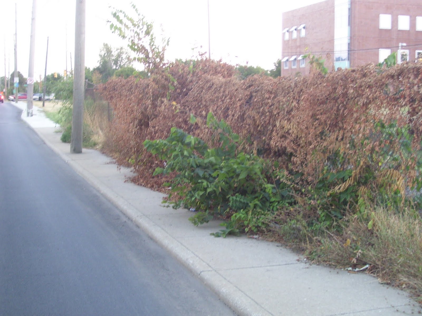 But if you would make a decision to not reconstruct this sidewalk because the surface is in good shape, wouldn't you recognize that the vegetation blocking the sidewalk needs to be removed?
Sunday, August 29, 2010
16th Street improvements
Below is a link to an article in the current issue of the Urban Times about an upcoming City project on 16th Street. It appears that the project will mainly consist of resurfacing the street, with some sidewalk and curb repair/replacement. The exciting part is the ability of a group of concerned citizens being successful in convincing the City to make some substantive changes to their plans to actually improve the street from a pedestrian's standpoint, most notably by providing curb extensions at the intersection of 16th & Delaware to reduce the crosswalk distance from five lanes to three lanes. Hopefully, this will also slow the speed of traffic and further increase safety for both drivers and pedestrians at this off-set intersection.
Ironic was the mention that the citizens' group was unsuccessful in convincing the city to reconstruct the sidewalk on the south side of 16th, west of Meridian (in front of Walgreen's parking lot), because the sidewalk there was too recently constructed to merit reconstruction. The citizens' group asked that the sidewalk be rebuilt away from the curb with a tree lawn between the street and sidewalk. One might ask why the City didn't build the sidewalk that way when it was previously reconstructed. Did we just realize that sidewalks built right next to a lane of moving cars are not inviting to pedestrians? The sidewalk probably could've been rebuilt as part of the Walgreen's redevelopment at this corner in 2007. Perhaps the City decided that it was more important to have some landscaping between the sidewalk and Walgreen's parking lot, which (according to the City's website: http://imaps.indygov.org/prod/GeneralViewer/viewer.htm ) appears to be built within a foot or so of the 16th Street right-of-way line, rather than providing a ten-foot strip of landscaping as typically required by the zoning ordinance.
Across Meridian Street, the construction of the new CVS did include reconstruction of the 16th Street sidewalk at the right-of-way line to give pedestrians a slight buffer from traffic. Unfortunately, the sidewalk along Meridian Street still hugs the curb, requiring pedestrians to walk within a misstep of traffic. While it doesn't appear that there is additional unused right-of-way on Meridian Street, there is a strip of landscaping between the CVS building and the sidewalk. Why not reverse the sidewalk and landscaping to provide some buffer between pedestrians and traffic?
http://www.urbantimesonline.com/2010/08/16th-street-getting-a-makeover-between-illinois-and-central/
Wouldn't it be refreshing to have the City actually propose improvements that would improve the pedestrian environment instead of it only happening as a result of active and informed citizens catching them in time to win some changes to the plans? Take a look at the newly rebuilt sidewalk on Dr. MLK Jr. St, between 16th and 21st Streets. Right next to moving traffic and worse yet, there are utility poles right in the middle of the sidewalk, such that there isn't even space to get a wheelchair around the poles without going off the sidewalk. Does not the Americans with Disabilities Act apply to such projects?
Monday, August 23, 2010
Pedestrian Safety Action Plan
Comprehensive study of pedestrian traffic fatalities and severe injuries in New York City:
http://s3.amazonaws.com/nytdocs/docs/458/458.pdf
UPDATE: 25-Aug-2010
This is a pretty thorough analysis of accidents involving death or severe injury. While it focuses much of its energy on pedestrians, it does analyze the rate of overall traffic deaths among all street users and determines that New York City is the safest city in the U.S. as far as traffic deaths are concerned. It adjusts for the surge in daytime population in Manhattan to stress that although the raw number of deaths and injuries is high, the rate per 100,000 population is quite low.
I believe that it alludes to NYC being even safer for pedestrians than the rate of death and severe injury per 100,000 population would imply, because there is actually a much higher rate of walking among the population there, among commuters, residents, and tourists. I've always wanted to see a study that attempts to compare pedestrian safety among U.S. cities by estimating something like miles walked per 100,000 population and using that to determine the actual likelihood of being killed or injured in a collision. My hunch has been that such a study would find that older, more dense cities, where walking is more common, are many times safer to walk in than our newer, lower density cities. It might also be interesting to have a study that factored in death or injury due to crime. If anyone is aware of such a study, please provide a link or other direction.
Subscribe to:
Posts (Atom)